Bhulekh Orissa refers to the digital land records of the state of Orissa, India. As the result of very serious efforts, the digitalized land map is a major achievement that offers the visitors of the website quick and secure access to accurate, up to date information about possession, ownership and size when it comes to the division of land in the state.
The Government of India has started the modernization of land records in 2008 and has by now achieved the complete digitalization of a vast and very complex body of data, the computerized Record of Rights (RoR) and many other types of information being now available for numerous states including Orissa.
Transparency is facilitated not only with the help of the complex data base made available via the portal, but also by easy usability – here is what the portal can be used for.
The Information You Can Access on Bhulekh Orissa

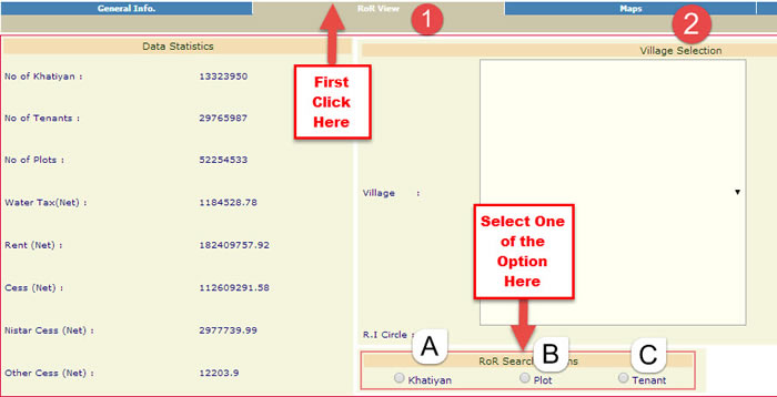
- Khatiyan – the legal document that contains all the details related to the ownership of the land;
- Plot – a khatiyan may comprise several plot numbers;
- Tenant – on the portal it is possible to enter a search to find the tenants of a plot as well.
How You Can Use Bhulekh Orissa
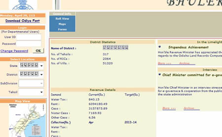
To be able to check the land records in the different districts of Orissa, the visitor needs to access the URL bhulekh.ori.nic.in and to follow a simple and self-explanatory procedure to find the information desired.

After having successfully downloaded, saved and installed the file, the user must select the district, the subdivision, the tehsil (an administrative unit often translated to English as „county”, but actually meaning a division somewhat different from a county, the term not being accurately translatable) and the name of the village for the property of interest.
The digitalization of land records comes with numerous benefits for the individual user of the portal just as much as for the government. The computerization of land registries makes work much more efficient at an administrative level; it facilitates land-related transaction, credit access and has a positive impact on numerous areas of economy and agriculture.
With the help of Bhulekh Orissa, available at bhulekh.ori.nic.in, it is possible to obtain the transparency necessary for more effective functioning of the local property market – anyone needing information about local land ownership rights, whether for business purposes or on some other end, the portal is the most efficient tool to gain access to accurate information.
6 thoughts on “Bhulekh Orissa – Information Availability and Transparency in Land Record Information”
Comments are closed.

nice
I wana need required to Best land
land
check all type of government work
I know my plot
I like this side